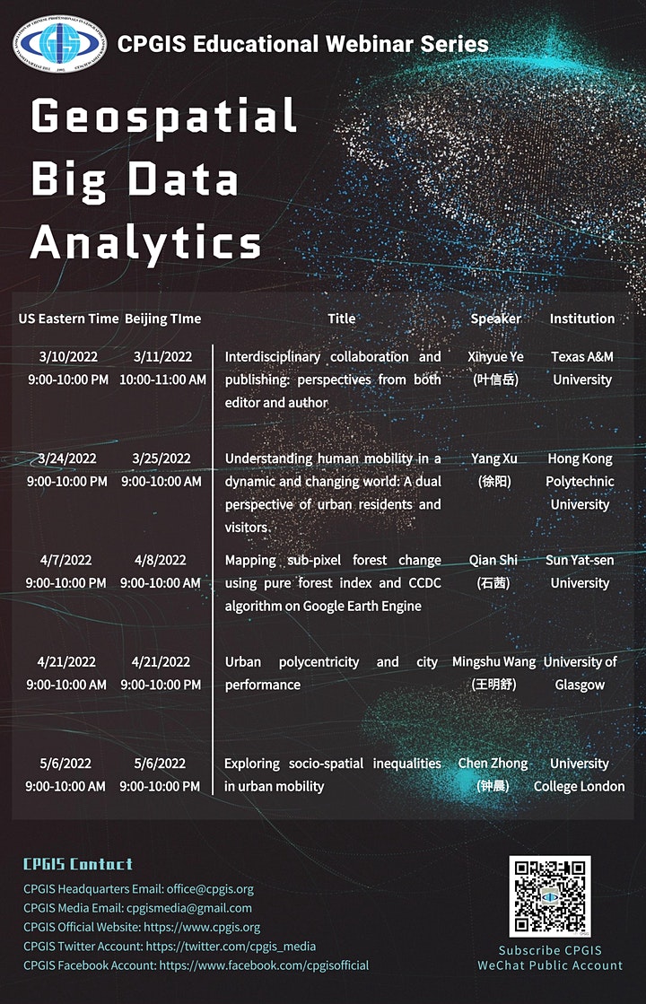
2022 CPGIS Educational Webinar Series on Geospatial Big Data Analytics
Geospatial Big Data is an extension to the concept of Big Data with emphasis on the geospatial component and under the context of geography or geosciences. It is used to describe the phenomenon that large volumes of georeferenced data (including structured, semi-structured, and unstructured data) about various aspects of the Earth environment and society are captured by millions of environmental and human sensors in a variety of formats such as remote sensing images, crowdsourced maps, geotagged videos and photos, transportation smart card transactions, mobile phone data, location-based social media content, and GPS trajectories. Big Geo-Data is “big” not only because it involves a huge volume of georeferenced data, but also because of the high-velocity of generation streams, high dimensionality, high variety of data forms, the veracity (uncertainty) of data, and the complex interlinkages with (small) datasets that cover multiple perspectives, topics, and spatiotemporal scales.
RSVP: https://www.eventbrite.com/e/278950437267
(US Time)
(3/10) Dr. Xinyue Ye (叶信岳) Texas A&M University, US
(3/24) Dr. Yang Xu (徐阳) Hong Kong Polytechnic University, China
(4/07) Dr. Qian Shi (石茜) Sun Yat-sen University, China
(4/21) Dr. Mingshu Wang (王明舒) University of Glasgow, UK
(5/06) Dr. Chen Zhong (钟晨) University College London, UK